UNESCO · city
Derbent and Naryn-Kala
Read the fortress, walls and old city as one UNESCO landscape over a full day rather than a quick viewpoint stop.
CAUCASUS ATLAS · 2026
A sourced five-to-seven-day Dagestan itinerary covering Derbent, Sulak Canyon, Sarykum, Gunib, Chokh, Gamsutl, Khunzakh and Samur.
Last checked: 26 August 2026Photograph: Alexander Novikov · CC BY-SA 4.001 · Quick answer
Dagestan is not a country but a republic within the Russian Federation. Use Makhachkala as an entry base and separate Sarykum–Sulak, Gunib–Chokh and UNESCO-listed Derbent into distinct days; do not compress the mountain villages.
02 · Geography and status
Mountain roads, canyon boat operations, border zones and protected-area access can change. Official route, road and institution notices take precedence over tour marketing.
03 · MAP
The OpenStreetMap base supports orientation; it does not guarantee administrative boundaries, open roads or permission to pass.
Open map ↗04 · ROUTE ATLAS
Review every stop individually and recheck sourced records on the day of travel.
UNESCO · city
Read the fortress, walls and old city as one UNESCO landscape over a full day rather than a quick viewpoint stop.
Canyon
Treat viewpoints, the lower valley and boating as separate options; do not promise all three without checking roads and operators.
Protected nature
Choose morning or late light; summer heat and protected-area rules determine the visit length.
Plateau · village
Give the high plateau settlement at least one night for views, village life and surrounding walks.
Village · hike
Chokh is a living village, while Gamsutl is an abandoned settlement reached on foot; they offer two distinct experiences even when visited on the same day.
Plateau · waterfall
The plateau edge and waterfall depend on flow, fog and wind; remain within safe viewing boundaries.
05 · Visual route
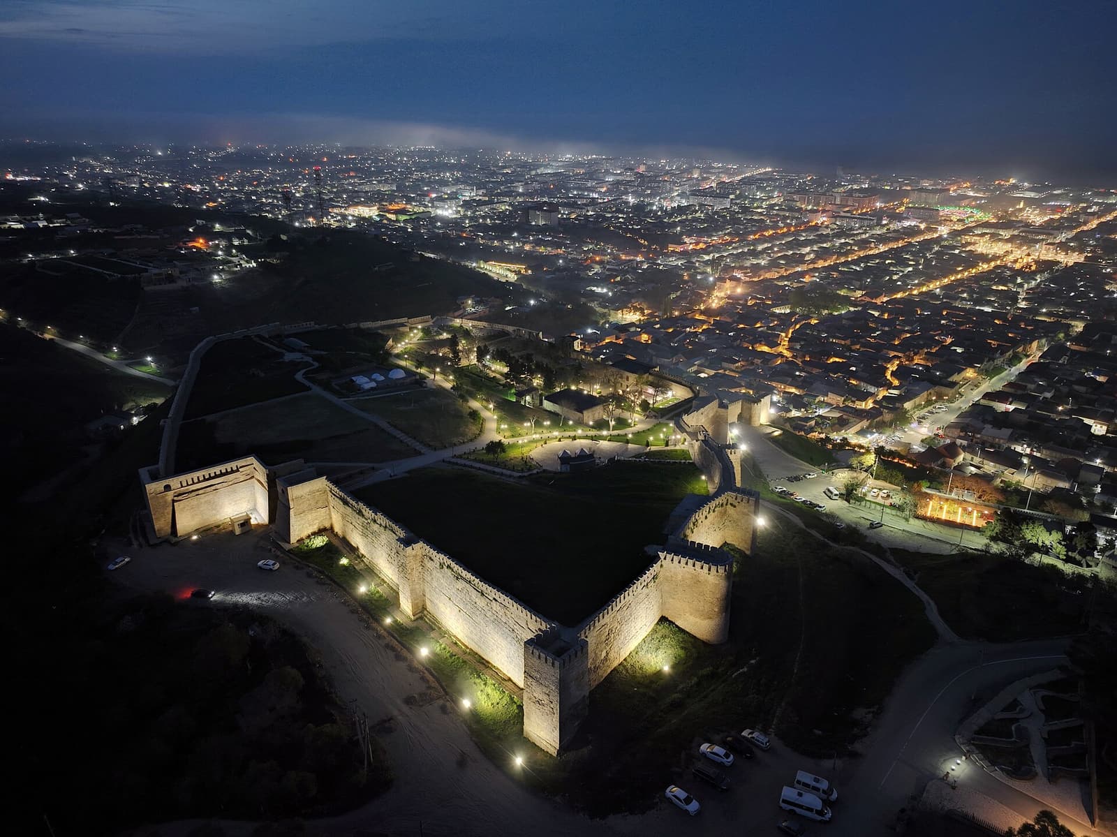
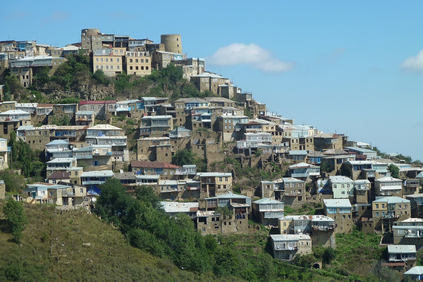
Day one can introduce Makhachkala and the coast; day two Sarykum and Sulak; days three and four a Gunib-based Chokh–Gamsutl circuit; day five Derbent. Khunzakh and Matlas need at least one more day, while Samur is a separate southern extension. Avoid long night transfers after mountain days: road time matters more than map distance.
Derbent is a walking and museum day; the Gunib–Chokh line is governed by road time, viewpoints and living village life. Gamsutl is a physical ascent to an abandoned settlement, not a visit to a living community. Do not treat homes, cemeteries or places of worship as scenery, and ask before photographing people.
Sarykum and the high plateaus can feel like different climates on the same day. Start the dune early in summer and carry layers for mountain rain and cool air. Grippy footwear, water and an offline map are basic. Waterfall flow and boat operation are not fixed; do not approach loose slopes or unprotected edges for a photograph.
Mountain villages, the Samur area and some border-zone routes may require identification, notice or local access rules. An official tourism listing does not prove the road or facility is open that day. Confirm vehicle class, driver experience and daylight return with a local operator or accommodation in writing; recheck prices before booking.
FAQ
A sourced five-to-seven-day Dagestan itinerary covering Derbent, Sulak Canyon, Sarykum, Gunib, Chokh, Gamsutl, Khunzakh and Samur.
No. It is a republic within the Russian Federation.
Five days cover Derbent, Sulak and one mountain-village cluster; seven are more realistic with Khunzakh or Samur.
A day trip from Makhachkala is possible, but do not combine viewpoints, lower valley and boating without a current road check.
Spring and autumn suit the coast and cities; summer and early autumn are generally easier for mountain routes once roads are open.
Last checked · 26 August 2026
Hours, prices, roads, entry conditions and weather can change. Before travelling, recheck each place with its official source and consult your own government's current travel advice.
Published: · Updated: